Hope for the best, plan for the worst. That is the general rule for mountain travel. Even a day trip in the mountains can quickly devolve into a safety nightmare if this rule is not observed. So last October we set out hoping for a great day, but planning to fail.
Storms circled Western Montana and the forecast promised for rain mixed with blowing snow at higher altitudes as Cory Soulliard and I drove north from Missoula. The forecast in the Swan Range called for a two hour blue-sky window we hoped to take advantage of, but we knew rain and snow would probably force us to turn around instead of completing our planned off-trail loop connecting four peaks, an unknown lake, and an even more mysterious trail.
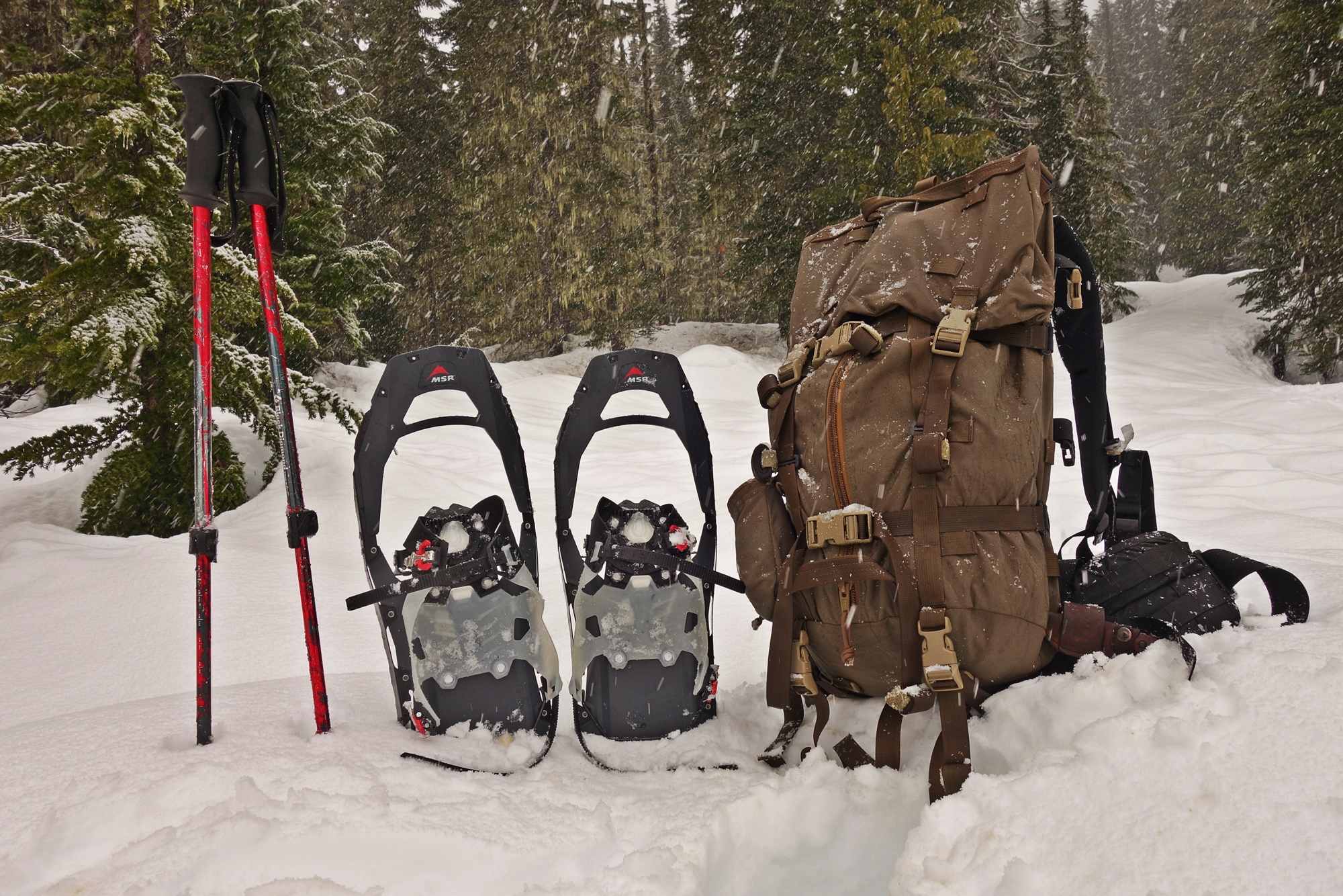
The drizzling persisted throughout our 90 minute drive to the Pyramid Pass Trailhead, which leads into the heart of the Bob Marshall Wilderness, one of the largest wilderness areas in the country. Even darker cells swirled above the Mission Mountains to the west as we shouldered our running packs and donned lightweight rain jackets. With a last glance at the dry, warm car we turned and began running up the trail.
The first five miles to Pyramid Pass we followed the path of an old road, which allowed for a relatively gradual climb to the pass. Although difficult to imagine any vehicles following the path we took, the route used to be monitored by Forest Service game officials on motorcycle.
Pyramid Pass is a popular gateway to the Bob Marshall. A large lake immediately on the east side of the pass typically provides excellent camping for groups looking for a single overnight, or launching a longer trip into the Wilderness.
When Cory and I reached the shores of Pyramid Lake we stopped and looked over the calm, misty waters, consulted our maps, the weather, and confronted our first decision. Go up, or turn?
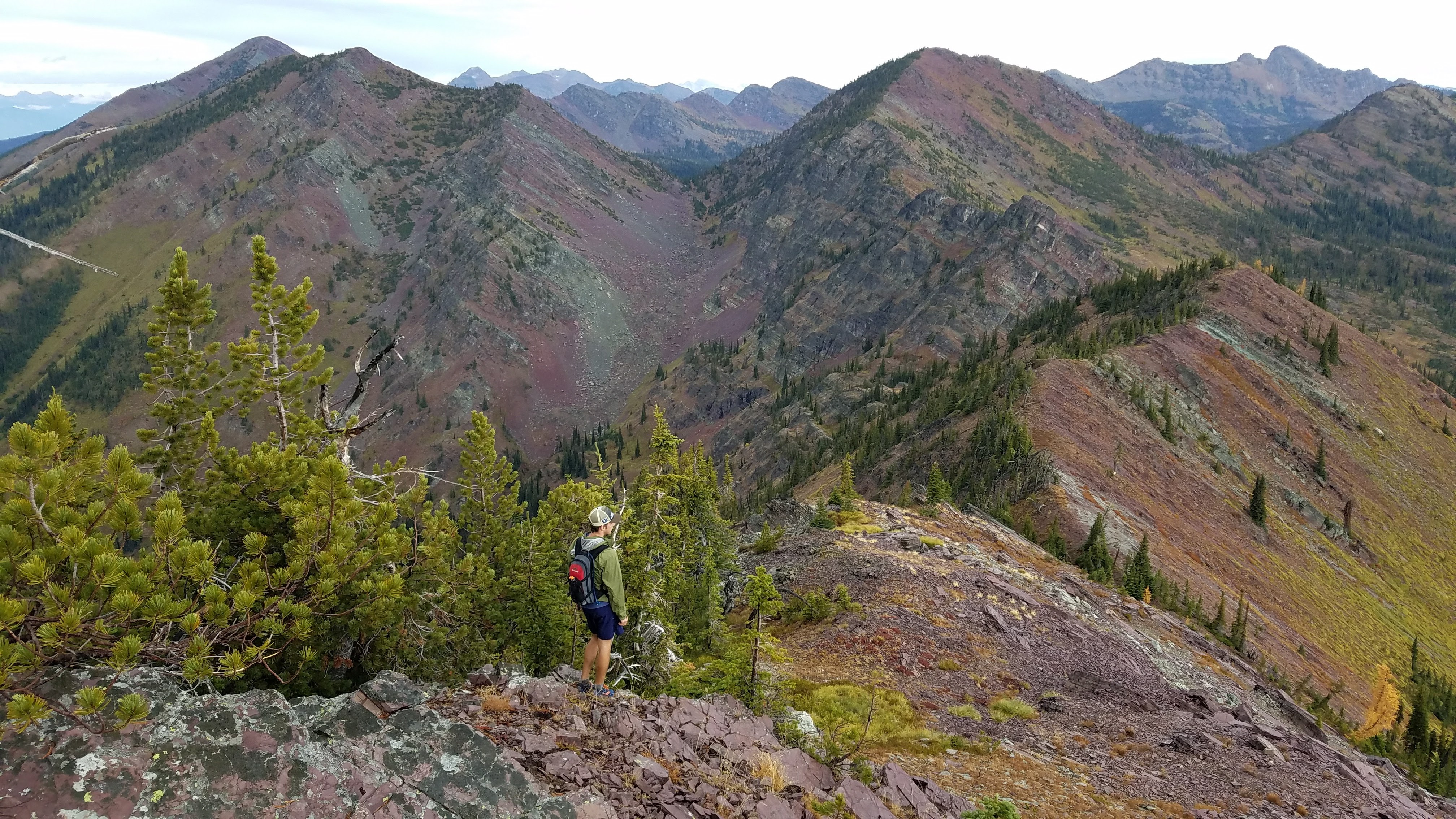
According to the clock we were in the first portion of the forecasted weather window and the rain had slowed to an occasional drop. So we chose to leave the trail and scramble up the wet talus field to the ridge towards Pyramid Peak, the first of four peaks along a connected ridge.
Running along the ridge, the Wilderness boundary that contained the Bob Marshall to our right, and the Seeley-Swan Valley on our left put smiles on our faces. Mist shrouded many of the typical visible valleys before swirling up and over adjoining peaks. To the west we watched the Mission Mountains enjoy a moment of sun before a snow squall slammed into the south flank of the 10,000’ peaks.
Although chaos swirled around us, the air in our immediate vicinity was damp and still: perfect weather for running, for the moment.
We paused at the top of Pyramid Peak for a quick nutrition break and weather assessment. Although we had meticulously poured over maps prior to our trip, we continuously prepared for the worst and adjusted our plans based on the conditions around us. From the top of Pyramid Peak our weather window appeared to be holding so we decided to push on to the next peak in line, Marshall Mountain.
After a rocky descent made more treacherous by the wet rocks, we arrived at a the pass between the two peaks: a narrow divide completely flat and protected from the elements. Tempting as it was to bail out here and bushwhack down to the vehicles, we clambered up the next climb and regained the ridgeline after a small buttress petered out.
The section of ridge prior to arriving on top of Marshall Mountain narrowed and increased in steepness when compared to Pyramid Pass. So far any obstacle was easy to bypass or scramble over, but each mile became more exposed.
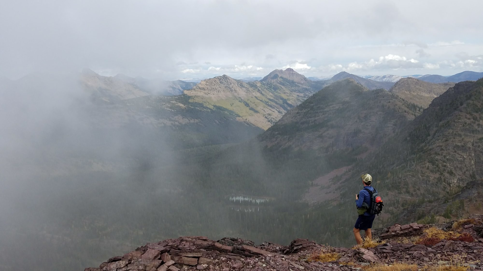
With increasing difficulty in mind we paused again on the top of Marshall Mountain for another snack, always an important and memorable moment of any outdoor adventure, and weather inspection. The squall that had hit the Mission Mountains across the valley now obscured each of the peaks. The squall had transformed into a storm, and the wind was blowing our direction.
Continuing to the next peak, Matt Mountain, seemed logical as the ridge swung to the west so the peak lay in the path of the quickest way back to the car if the skies opened.
From Marshall to Matt the chunks of rocks we had previously encountered turned to rock bands protruding from slope at 40% grade. Wet rock and grass continued to slow progress, but aside banging an ankle as I jumped off one of the rock bands, we emerged unscathed. Another steep climb brought us to the top of Matt Mountain and the crux of our decision making for the day.
At this point our weather window was rapidly declining. The storm enshrouding the Missions began it’s crawl across the valley separating us and the wind began to pick up. Being up on an exposed ridge with a only a light jacket, running shorts, and a Snickers wrapper to keep us warm did not sound appealing. We still had one more mountain in the loop we wanted to do, but it was obvious that was out of the picture. The next question was how to bail out.
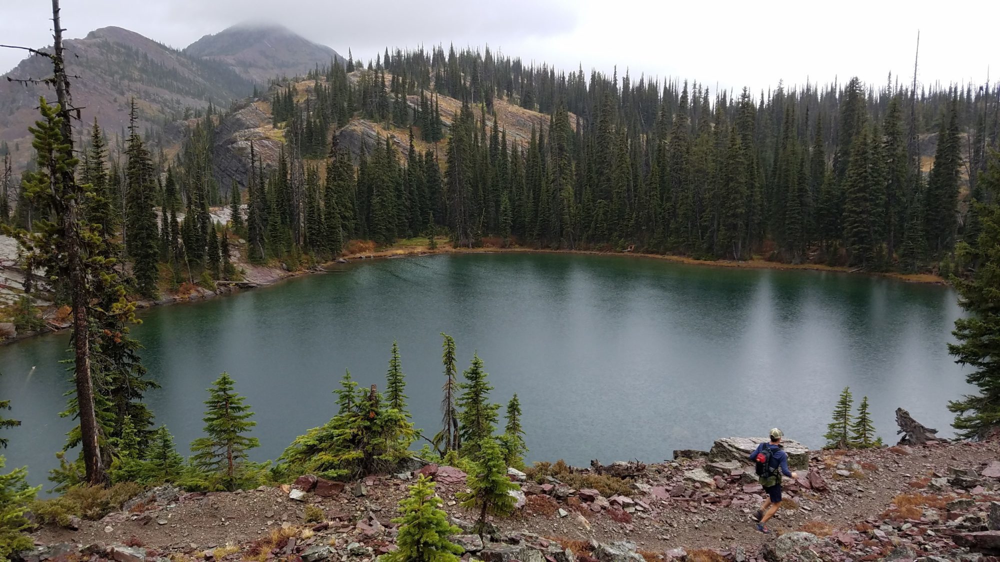
The blog-reading, map-scouring research I had done prior to this adventure now came into effect. I knew from a random comment left on a blog that there should – fingers crossed – be an unmarked trail leading from the lake below us, but we were not sure where it went. Our best guess was the horse outfitter a few miles below the parking lot.
The slope down to the lake appeared to be the steepest yet, but as Cory pointed out, the shoulder leading off the mountain due west looked more gentle. And if we squinted just right we could just make out the parking lot only a mile or so beyond the end of the shoulder. All we would have to do was aim due south when we popped off the slope, bushwhack a mile and either hit the road or the trail and follow that to the car. Of course, planning for the worst, we assumed there would be countless thorn bushes, awful sidehilling, and rock cliffs to negotiate, but still easy, right?
Actually, yes it was.
The shoulder we followed down turned out to be a main artery for elk travel so we simply followed the beaten path to where it intersected with the “small trail” I read about in the blog comment. This trail turned out to be a horse highway that made the descent incredibly quick.
Not wanting to drop below the level of the car and be forced to climb back up to the car, we followed a faint game-trail off of a switchback that traversed in the direction we hoped would lead to the car. This took us a quarter mile and across the creek before we lost it under a downed log. After no more than twenty yards of bushwhacking we stumbled onto an old, overgrown logging road, which lead us directly to the parking lot.
According to Murphy’s Law, planning for the worst means nothing bad will happen, but the moment an item is overlooked, it will become vital. Murphy’s Law does not apply to mountains. Planning for the worst means survival. We planned for the worst, and somehow managed to cross over three miles and three thousand feet of unknown terrain and bushwhacked less than a minute.
Astounded by our luck, we popped the hatch of Cory’s Subaru just as rain and hail began to pelt the parking lot, reminding us just how obliging the clouds were that day.
 About the Author
Forrest grew up exploring the trails and mountains around Flagstaff, AZ and returned to the West after running collegiately for Birmingham-Southern College in Alabama. He has since hiked the 3,000 mile Continental Divide Trail, placed in the top five in the US Sky Running Series, and is currently attempting to reach the high point in every mountain range in Montana. He lives with his wife and dog in Missoula, MT where he works at Runner’s Edge and coaches aspiring trail runners. Follow Forrest’s adventures at @forrestboughner.
Photo Credit: Votography Images

